Remote Sensing for Renewable Energy Site Selection and Impact Monitoring
Case Studies and Applications in Different Renewable Energy Sources
Solar Energy Case Studies
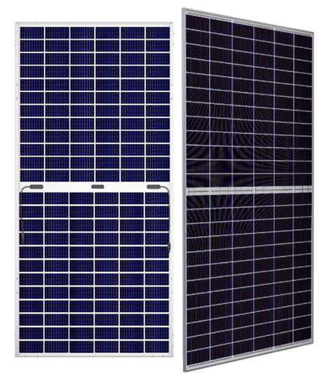
Remote sensing plays a crucial role in assessing solar energy potential. Analyzing satellite imagery, coupled with geographic information systems (GIS), allows for the precise mapping of solar irradiance across vast geographical areas. This data is vital for identifying optimal locations for solar photovoltaic (PV) farms and determining the energy yield potential of specific sites. Furthermore, remote sensing enables the monitoring of solar panel performance over time, identifying shading issues, and assessing the overall efficiency of solar power systems. This continuous monitoring is essential for optimizing energy production and maximizing the return on investment for solar projects.
Various case studies demonstrate the practical applications of remote sensing in solar energy. For instance, a study in the southwestern United States used satellite data to identify areas with high solar irradiance, leading to the development of a large-scale solar farm that significantly increased renewable energy generation in the region. Another example highlights the use of drones equipped with high-resolution cameras to assess the performance of individual solar panels on rooftops, allowing for targeted maintenance and improved efficiency. These examples showcase the power of remote sensing in optimizing solar energy production and making it a more sustainable energy source.
Wind Energy and Remote Sensing Applications
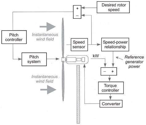
Remote sensing techniques are equally valuable in wind energy assessments. The ability to map wind speed, direction, and turbulence across large areas is crucial for identifying suitable locations for wind turbines. By analyzing data from weather satellites and radar systems, wind farm developers can determine the long-term wind resource potential of a specific site, ensuring that the chosen location can consistently provide sufficient wind energy for the intended capacity.
Furthermore, remote sensing enables the monitoring of wind turbine performance. Analyzing data from optical and radar sensors can provide insights into turbine operation, helping maintenance teams identify any potential issues early on. This proactive approach minimizes downtime and maximizes energy production. Another application involves using remote sensing to assess the impact of wind farms on the surrounding environment. This allows for proactive mitigation strategies and ensures that wind energy development is environmentally responsible. This crucial step demonstrates the importance of sustainable practices in the renewable energy sector.
Remote sensing data, combined with advanced modeling techniques, can predict the impact of future climate change on wind resources. This information is crucial for long-term planning and the development of resilient wind energy infrastructure. These insights contribute to the ongoing evolution of renewable energy strategies and a sustainable future.
Remote sensing data is crucial for predicting the impact of future climate change on wind resources. This information is essential for long-term planning and development of resilient wind energy infrastructure. These insights significantly contribute to the ongoing evolution of renewable energy strategies and a sustainable future.
The integration of remote sensing technologies with other data sources, such as meteorological data and terrain analysis, further enhances the accuracy and reliability of wind resource assessments.
Read more about Remote Sensing for Renewable Energy Site Selection and Impact Monitoring